

Inca Trail: Day 4 - Pacaymayo - Puyupatamarca
I slept like a baby last night. I am happy to report that I did not hear any unrecognizable animal noises at night. I could honestly say I adapted to the camping lifestyle much better than I imagined. It felt good to unplug from my phone. Besides my inability to check on Brian, the digital blackout was a welcomed break from the daily grind. I did not miss my daily news updates or check up on social media posts. That might be why I enjoy walking holidays like the Camino de Santiago as much as I do.
After washing up with a bucket of warm water, we had our quick breakfast before setting off the trail. Before leaving the base camp two days ago, I asked Jhon what was his favorite stage on the Inca Trail. He answered without hesitation that it would be the fourth day or third, depending on how you count. Jhon thinks today’s trail would be even more beautiful than the arrival to Machu Picchu. I have been looking forward to this day and seeing whether I agree with Jhon’s assessment. It puts some spring in my steps.
The weather up here could be a little bipolar.

The weather up here could be a little bipolar.
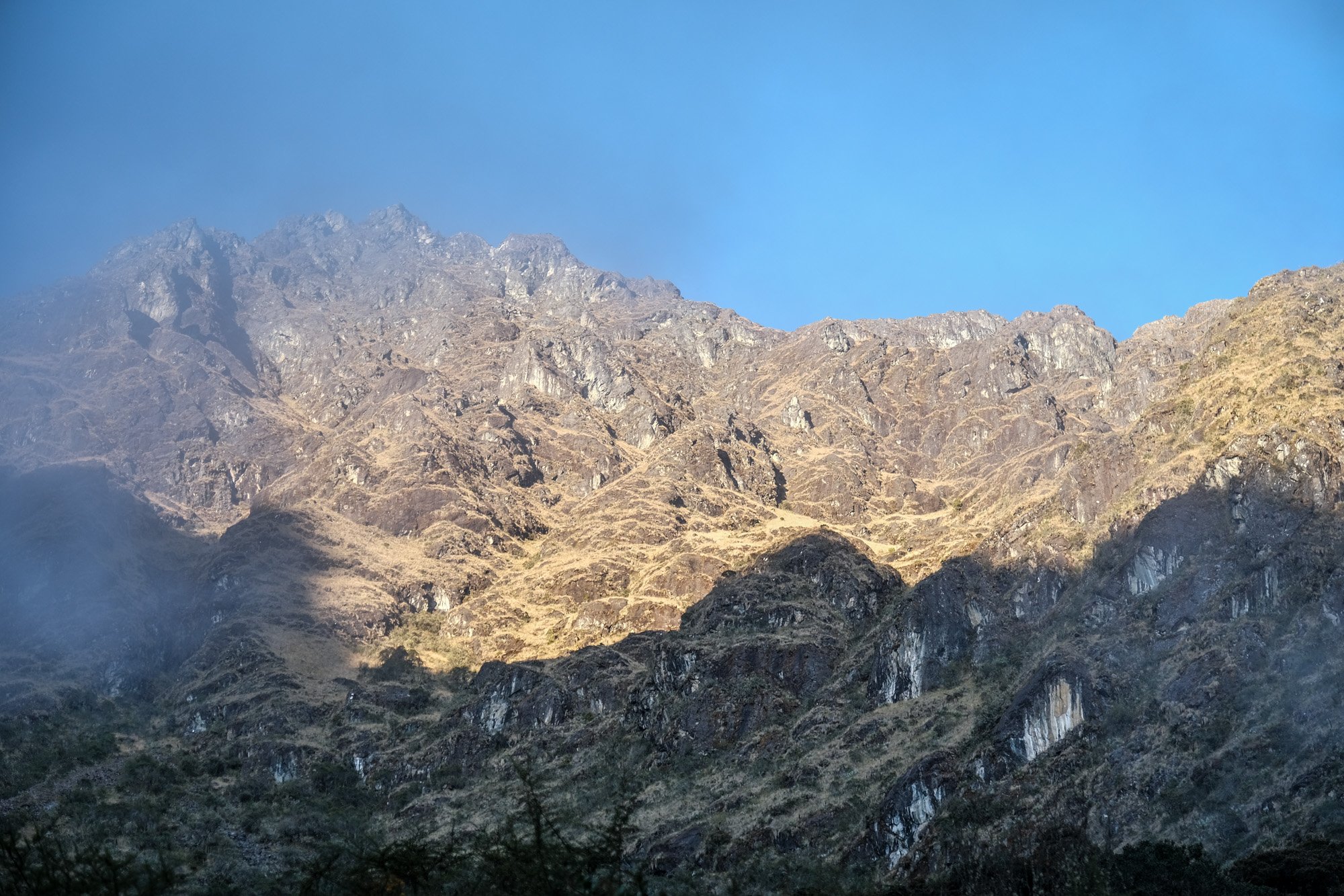
By the time we left the camp, most other groups had already decamped. I felt very pampered that Ecoinka has such a relaxed pace. On the other hand, it added pressure on stragglers like myself to keep up. I did not want to be one of those hikers who struggled through the dark to the camp this evening. The challenge for this morning was to hike up the Runcuraccay Pass, the second-highest point on the trail. After the Dead Woman’s Pass yesterday, I felt much less intimidated this time. Technically speaking, this pass is steeper than the one yesterday. But if Jhon was to be believed, we should be able to summit in only about two and a half hours.

The trail was definitely the most crowded at the beginning of the day.

Who knew there are orchids on the Inca Trail?

The trail was steep but satisfying.
Fortunately, the early morning sun was gentle. The mountain mist also added to an atmosphere of mystery as we climbed higher. The physical conditioning from yesterday also helped a lot. I found myself able to tackle a ten-minute stretch without rest. Luckily, our first major stop of the day was only forty minutes from the base camp. Runkuraqay is a small Inca site situated right along the Inca Trail. Despite its diminutive size, Runkuraqay is distinctive because of its geometric simplicity and purity. At first glance, this circular structure seems to be a religious site. The circular platform at the center seems ideal for sun worship to most casual observers.

Our first Inca site of the day: Runkuraqay.

A history lesson in action.

Our first Inca site of the day: Runkuraqay.
Contrary to common assumptions, Runkuraqay is not a religious site. The consensus among archaeologists is that this is an Inca tambo, an administrative/military post of the Inca Empire. The station contained supplies and provided lodging for soldiers. Back in the Inca times, the taxation system took several forms. Besides paying taxes with crisp and livestock, the Incas also instituted a system of tax labor called mit'a. It is a mandatory labor service all male citizens must provide regularly. These stations were often administrated by locals drafted from mit’a.
The two semicircular rooms on the side were the sleeping quarters for the soldiers. All along the walls are niches for candles and openings for ventilation. The central courtyard was supposed to be the gathering place of the livestock. According to Jhon, the construction quality is the most obvious clue that this site is not religious. The “rustic” construction of Runkuraqay is a world away from the precise dry ashler stone masonry you would find in an Inca temple. In other words, the Incas would not have constructed a temple of this poor quality. Even so, the Incas still followed the tried and true earthquake-proof technique of slanting masonry walls inward.

Runkuraqay.
Jhon recounted the day of no regulation when his group camped in the ruins of Runkuraqay. He also conceded that it was incredibly reckless in retrospect in terms of heritage preservation. Back in the day, there was no facility, and people would even urinate right inside the ruins. As much as we all find government regulations cumbersome and sometimes unreasonable, they are in place for the benefit of future generations. Nowadays, tourism is a driving force of preservation in Peru.

The beauty of Runkuraqay is best appreciated from high up.

It was only a matter time before our porters passed us on the trail.
Most archaeologists also believe that tambos like Runkuraqay were important communication posts that made the administration of the empire so efficient. The Incas had a vast network of messenger systems called casques (also chassis). Messengers, most often fit young men, would carry verbal messages and quipus, a unique record-keeping system made from ropes. The Inca messengers relay messages from station to station. It is estimated that a message could travel as far as 240 km a day. As spectacular as Runkuraqay is, Jhon said it is very unlikely that Inca rules or uppercase would ever hike this trial section to Machu Picchu. Instead, they would have chosen the easier route along the river.
To best appreciate the beauty of Runkuraqay, we ought to continue the hike up. From higher elevations, we could appreciate the architectural purity of the structure and the majesty of the surrounding valleys. The trail may be exceedingly steep, but I did not feel the same exhaustion and strain I experienced on the way to Dead Woman’s Pass. As we hiked up, the cloud began to lift, a transcendental experience. I felt like I was on top of the world, both mentally and physically. I felt very chirpy for the first time on the trial.

I could see why this is Jhon’s favorite stage on the Inca Trail.

After forty minutes, we arrived at a lake that appeared almost out of nowhere. It was another campsite popular with tourists before the regulations set in. The algae-infested lake may not seem significant or magnificent, but it is ecologically important for the surrounding community. Body of water like these is critical to local flora, fauna, and ecology. Jhon was able to tell the effects of the region’s climate change and worried about the local community’s future. It is ironic knowing that my jetting 12 hours to get here played a part in the climate crisis that Peru is experiencing nowadays.

Summit the Runcuraccay Pass.

Summit the Runcuraccay Pass.

Summit the Runcuraccay Pass.
From the lake, it was only twenty minutes until Runcuracay Pass. Chris had been waiting for me for about half an hour. He hiked up the adjacent summit to get a better view of the surrounding peaks. It turned out that the second-highest pass was a lot more pleasant than the Dead Woman’s Pass. Because the trail up to the top has more twists and turns, the views from the top are unexpected. I was ecstatic knowing that the remaining portions of the trial were mostly downhill. Perhaps I could keep up with Chris for the remainder from now on.
The British father and daughter duo showed up just as we were ready to depart. It was always great to meet up with my fellow hikers again. Even though we did not converse much, we enjoyed commiserating our shared struggles together. Like me, they were a lot more spirited and chirpy today. The excellent weather we had played a part as well. As much as I enjoyed Chris’s company, I wished they would be in my group. It was simply good to walk people at a similar pace as mine.

The weather was awfully nice on the other side of the pass.

The trail passes through some tight spots once in a while.
The trail down from the pass was spectacular but even steeper than yesterday. For the next hour or so, we passed through a beautiful valley and were blessed with wonderful views of Salcantay in the distance. Salcantay is the tallest peak of the Vilcabamba mountain range and the highest in the vicinity of Machu Picchu. Meaning “Savage Mountain” in the Quechua language, Salcantay holds special significance to the Incas. From Machu Picchu, the mountain peak aligns with the Southern Cross when it is at the highest point in the sky during the rainy season. The Incas, therefore, associate the mountain with the diety for fertility and rain.

Yes, the Inca Trail was pretty great.

A huayruro tree.

Yes, the Inca Trail was pretty great.
Along the way, Jhon pointed to a nondescript tree called huayruro by the side of the trail. Traditionally, the Andean people would gift newlywed this tree. The seeds of huayruro tree are prized for their bright red appearance. The tree symbolizes love and longevity. To Jhon’s dismay, these traditions faded in an increasingly urbanized Peru. It made me think of many Taiwanese cultural traditions I hated as a kid. I do not doubt that I would greatly appreciate these traditions nowadays.
An hour into our descent from the pass, a magnificent Inca fortress emerged into our view. Sayacmarca, meaning “Inaccessible Village” in Quechua, was the most impressive Inca site we have visited on the trail yet. It perches along a ridgeline and is only accessible through a steep stone staircase. Given the limited width of the slope of these stairs, we left our backpacks at the bottom of the steps. It was heartwarming to know that people were not overly concerned about theft on the Inca Trail. I suppose there weren’t too many places to hide on the trail; the government also has information about everyone.

The fortress of Sayacmarca.

The fortress of Sayacmarca is only accessible through a steep staircase.
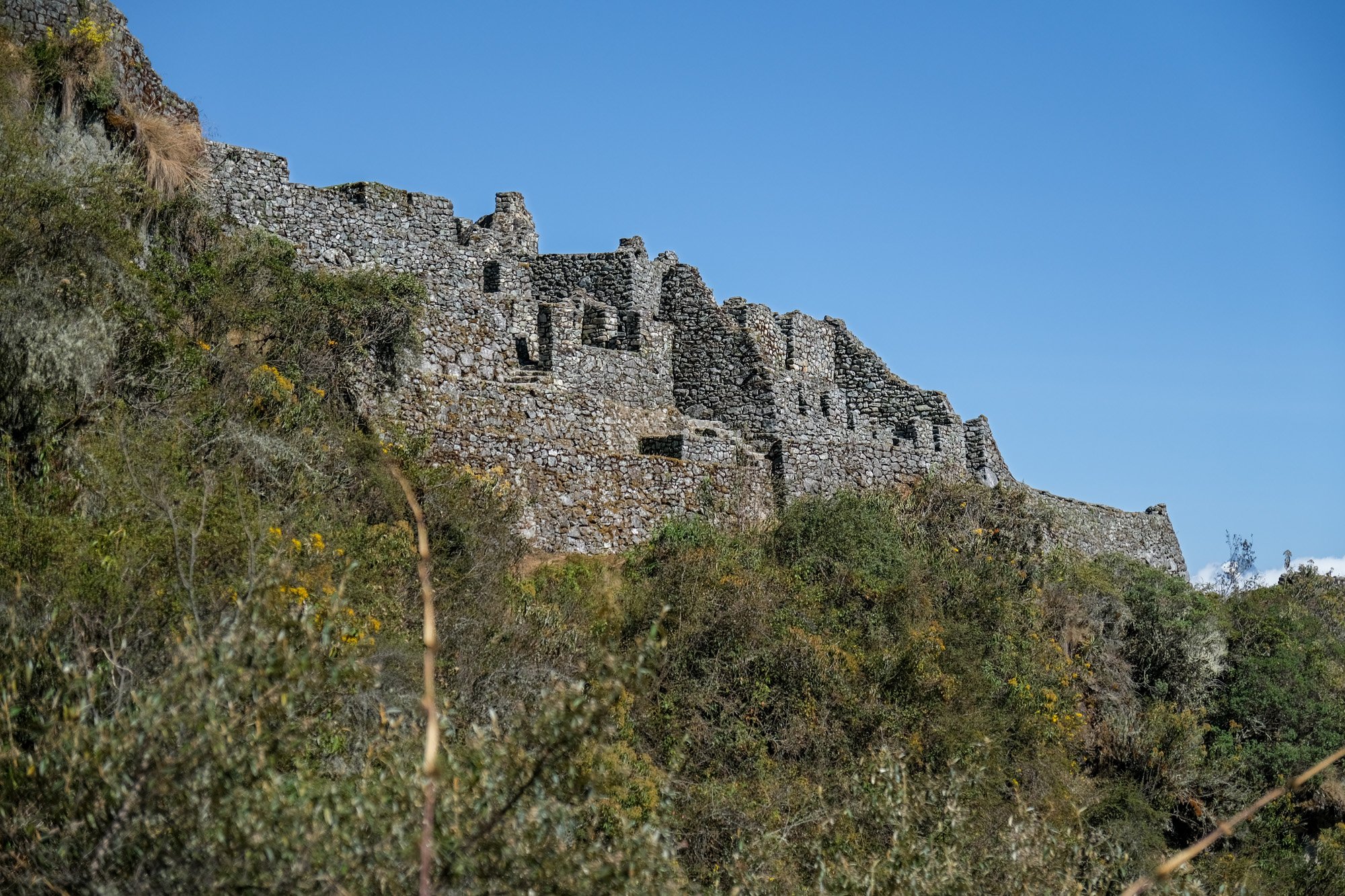
The fortress of Sayacmarca.
As we put down our backpacks, we overheard that the British girl discovered her pack had gone missing. She somehow managed to hike without it for over an hour before realizing it. Based on their best recollection, she must have left it somewhere between here and the Runcuraccay Pass. Well, I could only imagine the panic and helplessness of losing the backpack and her passport. Without it, she wouldn’t be able to visit Machu Picchu either. Just imagine hiking to the Sun Gate and being denied entry. That would be super tragic. Luckily, their guide offered to return to the pass to look for her pack.

The sweeping view from Sayacmarca.

The water channel connects to a natural spring at the top of Sayacmarca.

The water channel connects to a natural spring at the top of Sayacmarca.
After ascending the steep steps, we finally arrived at Sayacmarca. This impressive set of ruins is believed to be both a religious site and a residential complex for Inca nobles. We started our tour from the very top, where a natural spring fed an elaborate system of water channels that ran throughout the complex. I have been to enough ancient sites to know that reliable water was the most paramount consideration. Even though the connection to the spring has collapsed, the complex system of channels is still mighty impressive.
One unusual feature of Sayacmarca is the absence of agricultural fields, prompting archaeologists to believe in the site’s status of high importance. According to Jhon, as few as two dozen people lived here at its peak. Originally a small settlement of Qollas tribes, Sayacmarca was later fortified by the Incas and was supported by agricultural terraces down in the valley. The most evocative room of the complex is a horseshoe-shaped room that is ringed with trapezoid windows onto the Aobamba Valley. Described as a “living room,” the space was the main reception hall and the clergy's living quarters.

The horseshoe-shaped “living room” of Sayacmarca.
The most enigmatic architectural feature in Sayacmarca is a series of “pierced stone rings” embedded above and below each window opening. Their purpose is still debated today, and most seem to conclude they are likely the anchors to hold some external window shades. Speaking as an architect, I hope these rings have a more complicated rationale. As we wandered through the site, we noticed a few pieces of “ring stones” at the corners of a few grand rooms. Supposedly, they function like mortise for the Incan door locks. They are so well crafted that they seem almost like modern additions.

Pierced ring stone could be found in several of grand rooms at Sayacmarca.

A trapezoidal doorway is a common element in Inca architecture.

The fortress of Sayacmarca.
From the viewing platform of Sayacmarca, Jhon pointed out different Inca sites visible from this spot. Some were recognizable immediately; for some, we just had to trust Jhon that they were on the horizon. One of these Inca platforms in the distance is supposed to be right next to our camp for the night. Just imagine how amazing it would be to see flares signaling after nightfall. I secretly hoped for a small interpretive center on site. At the edge of the fortress is a big triangular platform that overlooks the valley. I found our British friends lounging in the sun without caring for the world. I just hoped their guide could somehow find her backpack.

The Sacred Rock of Sayacmarca.
At the center of Sayacmarca is an enormous granite boulder that is carved. It was unclear to us as to its religious meaning. At Machu Picchu, there is another enormous rock, commonly called the “Sacred Rock.” The Inca artisans purportedly sculpt the boulder to mimic the silhouette of the mountain range beyond. Perhaps it is natural for me to assume this peculiar-looking boulder at Sayacmarca is supposed to be a mimicry of a nearby peak or an Inca deity.
As much as we enjoyed the splendor of Sayacmarca, our lunch was calling for us at our campsite. Fortunately, our packs were still there waiting for us. In hindsight, we should have taken my passport and wallet from the backpack. Of course, I was also dying to find out whether that guide found the girl’s missing pack because leaving a backpack behind on a trail was something I would do. And if Brian were there, he would say the same.

The stacked stone in the front is said to be a barbeque grill.

A bathing area in Sayacmarca.

The view Sayacmarca from Conchamarca.
It was another steep descent down to our next Inca site: Conchamarca. This diminutive ruin comprises a series of agricultural terraces and three stone houses at the top. I began to understand why this was Jhon’s favorite stage. The concentration of Inca sites and the paved stone path was just what tourists dream of the Inca Trial. And because we started our day relatively late, the trail was practically ours alone. It was another two hours left until camp, so I had both the space and time for self-reflection. I have never felt better since we left the base camp two and a half days ago.

The agricultural terraces of Conchamarca.

The agricultural terraces of Conchamarca.

The toilet facility at Chaquicocha Campsite was probably the best on the trail.
In about half an hour, we arrived at Chaquicocha Campsite, situated at a dried lake. The sprawling site seems to be the biggest one on the trail yet. This was the campsite Alpaca Expeditions used for their second day. That meant the group had to bike the Dead Woman’s Pass and the Runcuraccay Pass in a single day. I honestly could not fathom covering that distance on just a second day. I know their objective was to make it to the Sun Gate for sunrise tomorrow, but their pacing seemed lopsided from one day to another. If you ask me, the monetary saving with Aplacha Expeditions is not worth it.
Speaking of pacing, I wish we had an official lunch stop at this campsite. There is a relatively modern toilet facility and great views toward the surrounding valley, including Sayacmarca. Instead, we were given a packed lunch with a basic sandwich, fruits, and chocolates. The cynic within me believes this was just a matter of convenience for the Ecoinka team to set up the kitchen only once today. Considering our good progress today, a leisurely lunch break would have been great.

This is why the Inca Trail is one of the greatest treks in the world.

Acrophobia may be an issue for some.

This is why the Inca Trail is one of the greatest treks in the world.
After our brief lunch stop, we were ready for our last push to our campsite today. According to Jhon, the remaining hike today was only ninety minutes. This section of the trail is arguably the most beautiful section of the entire trail. The trail runs along the side of the steep mountain. The trail's edge dropped steeply off the edge; it was as if I was walking on the sky's edge. There is no doubt that this is the most pleasant hike I have ever taken. With every turn, a new vista came into view. I felt like I was on “cloud nine.” Although I would love to have Brian here with me, I did wonder whether his intense acrophobia could ruin the experience for him.

This is why the Inca Trail is one of the greatest treks in the world.
Before long, we got to arrive at one of the Inca Trail’s famous tunnels. Just like highway engineers of modern times, the Inca engineers also sought the most rational path. But occasionally, the roadbuilders encountered physical obstacles that required tunneling. Measuring roughly 65 feet, this tunnel is still an engineering mystery. Without any modern tools, the Incas sculpted a passageway while maintaining the stone’s naturalistic character. Inevitably, I felt privileged to have this beautiful place all to myself. I could put myself in the mind of the Incas for just a moment.

The Inca tunnel is arguably the coolest experience on the trial.

The Inca tunnel is arguably the coolest experience on the trial.

The Inca tunnel is arguably the coolest experience on the trial.
Although we have had excellent weather thus far, the distant mountain peak has been obstructed by rolling clouds. It would have been great to enjoy a spectacular view of Salkantay. Before the trek, I have been sweating over the possibility of rain. Despite being the dry season, the odds of rain could not be ruled out. Less than twenty-four hours before reaching Machu Picchu, I was optimistic that I could avoid bad weather on this trek. Perhaps my waterproof hiking boots are not necessary after all?
Despite the general arid condition in this part of the trial, there was plenty of moss along the southern face of the slope. These succulent-like mosses were extremely beautiful and almost appeared coral-like. Their bright colors lighten up the trail and were such a wonderful surprise. John explained how the moss acts like a sponge, working to absorb and retain as much moisture from the atmosphere as possible; they are integral to the ecosystem's health. Jhon has been concerned about the steady decline of the moss along the trail over the past decade due to the changing climate. He even studied different species of moss and became a self-taught amateur ecologist.

The coral-like moss was a welcomed surprise on the trial.

A glimpse of Salkantay.
As we steadily ascended, we eventually came upon the mountain's ridge. For the first time in a day, I could see what was on the other side of the ridge. Much to my surprise, I saw a town down on the valley floor. This was the first sign of civilization we had seen in two days. Jhon pointed out that it was the town of Aguas Calientes, the gateway to Machu Picchu. If things go as planned, Brian should be in Aguas Calientes to meet us at Macchu Picchu tomorrow. I first checked my cell signal and saw whether I could at least check on Brian. Even though there were signals, they were not reliable for my calls or texts to go through.

This section of the Inca Trail is a perfect for photography.

A glimpse of Aguas Calientes, the gateway to Machu Picchu.
Soon after, I arrived at Puyupatamarca Campsite, the final camp of my Inca Trail. As Jhon promised, this was the most beautiful campground on the trail thus far. It happened to be the final mountain pass of the trek and overlooks the valley to the north. But before I could explore the site, it was call time for our very late lunch. When we thought Chef Juan was about to run out of ingredients or enthusiasm, this final lunch service was the most elaborate yet. It turned out to be a five-course meal service with elaborate vegetable carvings.

Puyupatamarca Campsite is regarded as the most beautiful on the Inca Trail.

I can’t believe this would be my last night on the trial.

The dessert course is always a highlight of every meal.
Despite our great appetite after the day’s hike, we can’t finish the copious amounts of food on the table. Chef Juan seemed very happy with how much we ate each meal. He even requested a picture with us. He saw it as a compliment. I do wish I spent more time watching Juan in action inside the kitchen tent. But at the same time, I am glad to turn my head the other way regarding food hygiene in a mobile kitchen. Ignorance could be bliss sometimes.
After lunch, we got to explore the campsite. Just beyond our campsite is the fourth Inca site of the day: Phuyupatamarka. Also nicknamed the “place above the cloud, the site is noted for elaborate water channels and ceremonial baths. Under normal circumstances, I would have rushed down the trail to take some photographs. But after an eight-hour hike, I was very content with looking down at it from the campsite. The thought of hiking another ten minutes down and up the steep trail was not for me then. After all, we are supposed to walk by Phuyupatamarka tomorrow morning anyway.

The Inca fortress of Phuyupatamarka.
At five o’clock, Jhon led us on a little hike to a nearby summit to get a better view of our surroundings. From the top, we had a panoramic view of the mountain ranges. Unfortunately, the clouds over Salkantay had only intensified. Otherwise, the view toward the glacial mountain is supposed to be glorious. Jhon then pointed to a nearby peak, where an Inca ceremonial platform is located. This was the same platform that he pointed out from Sayacmarca earlier today. I could not help but feel proud about the distance we covered in just a few hours.
But this spot's most exciting point of interest was a “little hill” down the valley. This little mountain was why we were here all along: Machu Picchu. Most tourists would be surprised that Machu Picchu is significantly lower than Cusco. At less than eight thousand feet above sea level, the fabled city is at the same elevation as the 82 km trailhead. Mentally, it almost felt a little anticlimactic to me. From this spot, we could barely make out the location of Sun Gate in the distance. It seemed like we still had quite a distance to cover tomorrow morning.

Puyupatamarca Campsite is regarded as the most beautiful on the Inca Trail.

The mountain of Machu Picchu is our ultimate destination.

The mountain of Machu Picchu is our ultimate destination.
Back down near our campsite, I got a nice perch on top of a massive boulder overlooking the valley. Before I knew it, here came my British hiking buddies. I was delighted to learn that she had recovered her backpack. She left it right at the top of the Runcuraccay Pass. Fortunately, it only took their guide less than an hour to retrieve the bag for her. Shortly after, my Texas hiking buddies Brian and Jill showed up. I was stunned when I heard they still had more than two hours left in today’s trek. It was clear that the ultimate goal for their group was to make it to the Sun Gate in time for the sunrise tomorrow. I could not help wondering whether I was missing out on this supposedly “classic experience” of the Inca Trail.
Compared to our campsite last night, the public facility here was grim. The only toilet station around was two porter potties, which were atrocious when I came by. As usual, the ones for the men were a lot worse. Based on my observations, only one out of five used the potty after seeing the state of it. I was grateful for the “private” chemical toilet Ecoinka provided. Not all operators offer chemical toilets. God bless those who did it without.

Puyupatamarca Campsite is regarded as the most beautiful on the Inca Trail.
Before dinner, Chris and I had a major decision: tipping! Much like the United States, tipping is integral to the Peruvian culture. However, the customary tip amount is more in line with European countries like Italy or Spain at 5-10% of the total bill. Regarding day tours, the recommended tips for tour guides range widely from $9 to a whopping $35 a day, depending on which website you read. With that in mind, what would be the appropriate tip for a multiday trek like the Inca Trail? According to government regulation, the minimum base pay for each porter is 500 soles, or $135, for the four-day trek. Because tipping on the Inca Trail is such a frequently asked question, Ecoinka provided an official recommendation in their pre-departure checklist:
“Tipping is entirely at your discretion. Many trip participants on our trek have requested guidelines to show their appreciation for a trail guide who has met or surpassed standards for excellent service. In such a case, should you feel so inclined, $30 would be a basic point of reference. In general, you can also consider another $30/$50 for the crew (to be shared between porters and cooks). Your trail guide will organize a “pool’ tip among group members for the trekking crew and later will openly distribute tips amongst them.”
For once, I am inclined to tip more than the recommended amount. $50 to be shared among eight porters and a chef would be just $1.40 per person daily. Considering how much work the team did for us over the past few days, I can’t tip them such a minuscule amount. Considering the small size of our group, Chris and I decided to tip 12%, based on the percentage of the overall cost of the tour. That ended up being about $120 a person. In addition, I also wanted to tip extra on Brian's behalf. Because he aborded the Inca Trail on the first morning, there were more porters than necessary. I wanted to ensure the porters were not unfairly penalized financially due to Brian’s premature departure. I added an additional 50% to my portion of the tip, bringing the total to $180. While this was quite a large chunk of money, it felt much better than tipping the waiter 22% back home for a mediocre meal.

I could not wish for a better view from my tent.
Before we knew it, the darkness began to descend. Jhon asked us whether we would like to present the gratuity for the porters in the morning instead. Chris and I were both happy about that. The last thing we wanted was for the porters to be unhappy about their tips. I was happy to delay the awkwardness until the very last minute. A chef might even add some “special ingredients” to the final dinner because of inadequate tips. Who knows, right?

I could not wish for a better view from my tent.

I didn’t know you could take a decent picture of the Milky Way on iPhone.
Anyway, I can’t help feeling a little melancholic about this final night on the trail. In the blink of an eye, my Inca Trail journey was ending. Walking the Inca Trail has been on my bucket list for a few years now, and it was a little out of my comfort zone. I felt very grateful to have this opportunity. As we were wrapping up our dinner, a group of hikers appeared from the trail with headlights. John told us it was the same hikers hiking down the Dead Woman’s Pass the previous night. While Chris thought they were fool-hearted, I admired their perseverance. Although it was unfortunate that they had to walk the most beautiful section of the trail in total darkness. On the other hand, the Milky Way above was spectacular.