

Westman Islands - Iceland’s Back Door
As a devotee of Rick Steve’s travel philosophy, I always wish that his catalog of guidebooks would expand well beyond popular destinations like France, Italy, Spain, and Germany. As he often explains, his decision to publish a guidebook for a particular destination is a matter of financial calculation. With Iceland fast becoming one of the most popular European destinations for Americans, it was no surprise when I learned that Rick Steves began publishing an Iceland guidebook a few years ago. One of his travel philosophies was discovering Europe's “back door.” These are little-traveled places that travelers have neglected because of poor infrastructure or ineffective tourism boards. Very often, these back doors of the past, such as Cinque Terre, have become full-fledged blockbuster destinations today.

A view of Westman Islands from the port of Landeyjahöfn.
So when I read that Rick’s team has identified Westman Islands as a back door for Iceland, I was immediately intrigued. Given how well-trotted Europe is as a continent in this internet age, discovering a new back door was like unearthing a treasure. I struggled to fit Westman Islands into my Ring Road itinerary with only ten days available. But then I read that Goslok Festival, also known as the End of Eruption Festival, I knew I would regret skipping out. And boy, that was the best decision I made on this trip.
Vestmannaeyjar vs. Heimaey vs. Westman Islands
There was relatively little information on the Westman Islands compared to elsewhere we visited on this trip. Before I purchased Rick Steve’s guidebook, I did considerable research on everything Westman Islands. For the longest time, I often encountered two names used for this area: Vestmannaeyjar and Heimaey. It took me quite a long time to understand the relationship between the two. Vestmannaeyjar is the Icelandic name for the Westman Islands and refers to the whole archipelago, of which Heimaey (Home Island in Icelandic) is the largest and the only permanently inhabited island. In short, there is a town called Vestmannaeyjar on the island of Heimaey, which is a part of the archipelago of Vestmannaeyjar (Westman Islands). Makes sense?
Getting There
One main reason the Westman Islands have been off the radar for most visitors to Iceland is its geographic isolation. Located roughly six miles from mainland Iceland, there are only two ways to get to the Westman Islands: a short flight from Reykjavík or a car ferry from the port of Landeyjahöfn. Both options are somewhat weather-dependent, and each has its own pros and cons. Given that we already had a rental car for our road trip around the country, taking the ferry seemed like a no-brainer. Throughout the year, Herjólfur offers six or seven roundtrips throughout the day. From the ferry port, we could see the archipelago in the distance. They tower over the ocean like a mirage, and it immediately pulls us in psychologically.

Waiting to get on Herjólfur ferry.
One debate I had with myself was whether to take our rental car to the island. The island of Heimaey measures about 5 square miles, with the town of Vestmannaeyjar clustered near the harbor area in the north. Although we could technically walk from one end of the island to the other in just under 30 minutes, I ultimately concluded that the flexibility with our car was worth the 6,000 ISK roundtrip fare. Another unusual consideration was the risk of the sand storm at Landeyjahöfn. The south coast of Iceland is particularly known for strong winds, and I have read reports of damaged cars parked in the open parking lot at the ferry port. Ultimately, it was not worth the risk. Since we already had a cracked windshield on this rental car, minimizing further damages seemed to be a good call.

Abroad the Herjólfur ferry.

Getting into the Vestmannaeyjar Harbor.
Our visit coincided with the popular Goslok Festival, which necessitates advanced reservation for the car transport. Otherwise, an advanced reservation is recommended but not required. This was our first time on a car ferry abroad, and it was quite a fun experience. The leisurely 35-minute journey was spectacular. Besides the main island of Heimaey, most other islands feature sheer cliffs and large colonies of seabirds. Some even have a community lodge perched high on the cliff. Indeed, Westman Islands is home to what is often dubbed the "loneliest house in the world.” Even before we stepped foot on the island, we already felt the magnetism of this place.
The 1973 Eldfell Eruption
For foreign visitors like ourselves, Westman Island’s claim of fame is probably the eruption of the Eldfell volcano in 1973. On the night of 23 January that year, a giant fissure emerged from the ground out of the blue. In a matter of minutes, it quickly developed into a 2-kilometer gap in the earth that cut across the eastern shore of the whole island. Suddenly, the locals found themselves in the shadow of an active volcano. Many had only a few minutes to evacuate their homes and head to the harbor for safety. Luckily, most of the island’s fishing fleet was in port that evening because of the inclement weather. It was miraculous that It took only a couple of hours to evacuate the island’s five thousand inhabitants to the mainland.

A serene view of red-color Eldfell.
For six months, the lava marched toward the town and threatened to bury most of the town. But the most terrifying prospect was the possibility that the lava flow would seal off the natural. A sealed harbor would have decimated the island’s fishing industry and the economy. For weeks, those who stayed behind did their best to protect the harbor by pumping seawater against advancing lava. Ironically, this rescue effort elongated the inlet, thus actually improving the quality of the harbor. On July 3rd of that same year, the official announced the cessation of eruption. Ultimately, the island grew by a quarter in size, and the Eldfell reaches an impressive height of 650 feet.
Most islanders had to shovel a few stories tall of ash pumice stone from the houses. In the end, roughly over four hundred houses, about one-third of the island, were completely destroyed. Nearly a quarter of the residents never returned. Even today, Heimaey’s population still stands at approximately 80% of what it was before the eruption. While many families who lost their houses stayed for a few more years to rebuild their lives, many decided not to set foot on the island until decades later. I could only imagine what kind of PTSD they must have experienced.

Walking along the rim of Eldfell crater.

Historic photograph of the eruotion from this very spot.

I would not have ever imagined that was a lava field before.
A definite highlight of the visit was a hike up the Eldfell itself. Compared to the nearby dormant Helgafell volcano, Eldfell’s distinctive color and shape stand out against the surrounding landscape. During the sunset, it glows like a beacon amid the surrounding landscape. No matter the weather, climbing up Eldfell is a must. It was a relatively gentle 25-minute hike to the edge of the crater. The lower half of the volcano was covered by an endless blanket of Nooka Lupinus, an invasive species first introduced to Iceland about a century ago to combat soil erosion. Knowing they were growing out of control nationwide, I did not feel bad about trampling over them on the way to the top.
About halfway through the climb, we came across a signpost with a historic photograph from before and during the eruption. The signpost marks the very spot where these photos were taken and allows us to compare the dramatic change in the landscape easily. You can’t see those photos and not be amazed by how there was so little causality from that day. Only one elderly died in the whole incident from toxic smoke inhalation. Though the label “Pompeii of the North” has often been attributed to the Eledfell eruption, the locals would quickly add that it was not merely as tragic as the Vesuvius eruption. Despite the lack of warning, the well-rehearsed evacuation plan paid off.

A partially excavated house on Gerdisbraut.

A partially excavated house on Gerdisbraut.

These “random” signposts in the lava field mark the locations of the streets below the lava.
All across the island's eastern side, there are still countless reminders of the eruption. Over the years, many partially buried houses were left there as a living memorial. But the island's most poignant stroll was walking on the lava field closest to the harbor area. Nooka Lupinus has now taken over the once barren field. Nestled among the overgrown vegetation was a series of seemingly random signs with names of streets. They mark locations of the former street fifty-plus feet below the lava. By the harborfront is a map overlaying the pre-eruption satellite image with the post-eruption landscape. The juxtaposition was striking, and it put everything into spatial perspective.

Overlay of the current land country with the pre-eruption Vestmannaeyjar.

The crushed concrete water tank by the harbor of Vestmannaeyjar.
At the northern edge of the lava field is the remnant of an old concrete water tank, which was crushed by the enormous weight of the lava. This particular section of the town once hosted a number of the town’s former infrastructure facilities. This area holds special significance as it was where the rescue operation of pumping seawater toward lava took place. Also displayed was a historic section of the old underwater water pipe that served the island faithfully for decades. The preservation and display of these artifacts all told a wonderful story of what happened in 1973.

Hiking down Eldfell.

The “ash pole” showing the depth of the lava that has to be dug out at this spot.
Of all the eruption's artifacts, my favorite was the so-called “ash pole” located just across from Hotel Vestmannaeyjar. The pole marks the exact depth of pumice at this very spot. For those in doubt, there is a photo of this block just after the eruption for proof. I suppose this is similar in concept to all the flood level markers you see all across continental Europe.
Eldheimar Museum
By far, the most important tribute to this tragic event is the Eldheimar Museum, a community museum dedicated to the history of the Eldfell eruption. For decades, the town had little to show visitors about the eruption but a few semi-buried ruins. Somebody in the city hall had the idea of excavating one of the buried streets. They soon discovered that almost every house they unearthed was nothing but a pile of rubbles. After decades of enormous weight, these houses did not stand a chance. Well, all except just one: house No. 10 on Gerdisbraut. This house was home to Gerður Sigurðardóttir and her young family. Like all other islanders, Gerður only had minutes to evacuate her from her home. Little did she realize that the next time she would see her home again would be more than 35 years later.

The contemporary architecture of Eldheimar Museum is stunning.
With permission from Gerður and her family, the town constructed a state-of-the-art museum over their fully excavated house. There was an eerie atmosphere inside the museum. Knowing this was a family home; we couldn’t help feeling like we were prying into the private life of the family. In front of the house are three monitors, which control operable cameras installed inside the house ruins. Through the monitors, we could discover various objects left behind on that fateful night. From baby food to a can of baking powder, seeing what was left behind definitely made us think of our own home. What would we have taken with us if we were given five minutes to evacuate our apartment?

Operating the camera inside the ruin of No. 10 on Gerdisbraut.

The ruin of No. 10 on Gerdisbraut.
Indeed, that is one of the most fascinating questions. Contrary to “common sense,” most evacuees did not take valuables. Instead, most carry bare essentials such as warm clothing and medicines. There are stories of how families took only food with them because they expected the evacuation would be temporary. It was not until later that people lamented the loss of items of sentimental value. Even during subsequent days and weeks, those who evacuated valuables focused on items like expensive equipment or residential appliances over personal artifacts. It did make us wonder what we would have done if we were in their shoes.

Checking out some of the items that were left behind the night of the eruption.
The most moving part of the museum for us was the video recording of one of the first visits by Gerður to her newly excavated home. She recounted her memory from that night and helped us to make sense of the context of the house about the eruption. Watching her describe standing in the hallway and seeing the lava gushing out the window sent a chill down our spine. Because no one was aware of the presence of this volcano, the eruption must have sowed confusion and left islanders in awe. All around the museum are pictures of the eruption; the town's proximity to the crater is terrifying. In particular, the photograph of the Landa Church (Landakirkja) in front of the crater is particularly striking. Having just driven by this church on the way to the Eldheimar Museum, it is not an image I could forget anytime soon.

The iconic photograph of Landa Church against the background of a raging volcano.
Besides the obvious centerpiece, the museum exhibits are divided into four periods: pre-eruption island life, the night of eruption, the immediate aftermath, and the long-term rebuilding. The eruption event became the key marker on the historical timeline. The museum seeks to become an institution of record for the younger generations born after 1973. Counterintuitively, those who survived that day did not talk much about their experiences to others because this was a collective experience shared by the whole island. The exhibit examines the eruption from a scientific and socio-economic point of view.

The ruin of No. 10 on Gerdisbraut.

Interactive exhibit showing the progression of Eldfell eruption and lava flow.

The corten steel siding pays tribute to the reddish hue of Eldfell.
Opened in 2014, the museum deploys some of the most cutting-edge technology in its exhibition design. The entire ground floor of the museum has no text on display. Instead, every visitor has a smart audio guide with advanced geolocation capability developed by Icelandic Locatify. As we move from one gallery to another, the narration starts automatically. The whole experience felt effortless, and this narration-based navigation maximizes the sensory experience of the eruption. For many survivors, footage and recordings of the volcano’s rumbling sounds are emotional triggers that are still difficult to confront. The evacuation siren and footage of that day are particularly challenging. The closest comparison I could draw may be the National September 11 Memorial & Museum in New York City.

Brian was looking for the owner of this puppy.
On the museum's upper level, there were several small exhibits on the geology of volcanos and the ecosystem that developed after the eruption. But what probably interests visitors more would be an exhibit on the island of Surtsey. Part of the Westman Islands archipelago, Surtsey, the southernmost point of Iceland, emerged from the ocean floor during an eruption ten years before Eldfell’s. As one of the new volcanoes in the modern era, Surtsey is perhaps the most intensively studied eruption in history. Afterward, the Icelandic government prohibited everyone except scientists from landing on the island, thus creating a unique and pristine environment for the study of bio-colonization from founder populations. The delicate ecosystem of Surtsey became one of Iceland’s three UNESCO World Heritage Sites in 2008.
A Capsule of Icelandic History
Iceland’s history is relatively short by European standards. Unlike much of the “New World,” there was no indigenous population in Iceland before the arrival of the Vikings in the 9th century. Legend has it that one of the first settlers of Iceland, Hjörleifur Arnarson, was murdered by his slaves that were brought with him from present-day Ireland. Those slaves escaped and sought refuge in the Westman Islands. Many believe the island’s name (Vestmannaeyjar) references the Irish slave (the island of the western man). More than Reykjavík, I think Vestmannaeyjar probably epitomizes the history of Iceland better than any other town.

Heimaey Stave Church, a gift from the Government of Norway.
Greeting any ferry at the mouth of the harbor is a striking wooden building; it was unlike any other structure we saw in Iceland. Constructed in 2000, Heimaey Stave Church (Stafkirkjan) was a gift from the Norwegian government to celebrate a millennium since Iceland’s conversion to Christianity in the year 1000 and a symbol of a deep historical link between the two nations. It was a replica of the Haltdalen Stave Church in the Norwegian town of Haltdalen. Though Nordic, the stave church has never been part of Iceland’s architectural tradition due to the scarcity of timber. After a week of seeing Icelandic churches, the understated extravagance of the stave church was refreshing. The interior and the altar were also meticulously replicated. It was our first time visiting a starved church, and we could feel a sense of mysticism.
A truly underrated gem on the island is the humble Sagnheimar Folk Museum. Located on the upper floor of the community library building, the museum showcases the tumultuous history of this little island. Besides the 1973 Eldfell eruption, the island has many other incredible tales. Perhaps the most incredible episode of the island’s 1,300-year history was a raid by North African pirates in 1627. When we often think of pirates in this part of the world, we often think of the Vikings. Never for a minute that I thought the North Atlantic would be subjected to piracy from the Ottoman.

This is the “Pirate Cove”, the landing beach of the North African pirates.
Known as the Turkish Abduction (Tyrkjaránið), the pirate raid lasted three full days. The raiders went house to house and committed all sorts of unspeakable shenanigans. In the end, 34 islanders were killed, and 234 were taken away to be sold in a slave market in Algeria. Nearly overnight, the island lost more than half of its population. Among those captured was Ólafur Egilsson, the minister of Westman Islands. He was abducted with his wife and two sons. Amazingly, Egilsson managed to negotiate with his captors to raise money for ransom for the rest of the Icelandic slaves, including his own families. He set off to Copenhagen to lobby the Danish king, ruler of Iceland at the time. Unsurprisingly, paying ransom for peasants from a far-flung corner of the empire was pretty low on the king’s list of priorities.
Unsuccessful in Denmark, Egilsson returned to Iceland to fundraise among Icelanders. After eight years, he managed to raise enough funds to negotiate the release of 34 Icelandic slaves. Several years later, additional hostages were released because of his favor. Overall, roughly fifty of those captured managed to return to Iceland. Egilsson’s extraordinary memoir became an important historical document in Iceland and is a must-read for all Icelanders. At the Sagnheimar Folk Museum, the story of the raid was told through a series of cartoon strips. Despite its childlike innocence on the surface, its content is extremely graphic and gruesome. It does not shy away from images of pedophilia, beheading, and sodomy. They were memorable for all the wrong reasons.

Innocent cartoon of the Turkish Abduction at Sagnheimar Folk Museum.

Exhibit on the sea rescue service of Heimaey at Sagnheimar Folk Museum.

A 3D wooden model of the pre-eruption Heimaey at Sagnheimar Folk Museum.
Westman Islands also had an interesting connection to the United States. In the mid-19th century, two Icelandic converts of the Mormon church in Copenhagen returned to Iceland to evangelize their new faith. Their preaching was particularly effective on Westman Island. In a matter of a few years, nearly half of the islanders converted to Mormonism and emigrated to Utah, namely the Spanish Forks. The museum has a special exhibit with photographs of all the islanders who moved to Utah. It was a collaboration with researchers from the University of Utah. Over the past few decades, the Westman Islands became somewhat of a place of ancestral pilgrimage for Icelandic Americans. I could only imagine the outburst of emotion from their direct descendants.

The enigmatic Guðlaugur Memorial.
To round up many of Westman Island’s extraordinary tales, I love to share the story of Guðlaugur Friðþórsson, a young fisherman in his mid-20s. On 11 March 1984, his fishing boat capsized a few miles off the island of Heimaey. Guide by a lighthouse in the distance, he managed to swim to shore, a feat that was unimaginable in the frigid water of the North Atlantic. After several hours in the water, he still had to hike barefoot for more than an hour through a rough lava field to look for help. His feat of endurance made him an international legend, much to his dismay and reluctance. After all, he lost four of his fellow crew in the incident. A big section of Sagnheimar is dedicated to developing sea rescue services and fishermen who lost their lives in the ocean.
Unparalleled Beauty
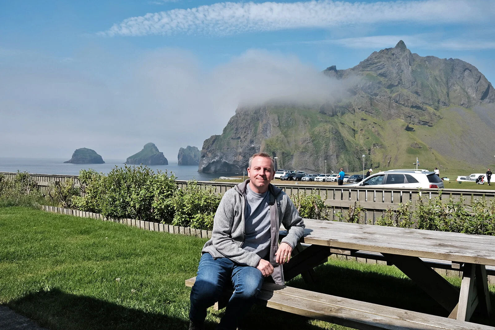
Fascinating history aside, Westman Island’s physical beauty alone warrants a visit. Unlike Iceland's mainland, the island’s geography is distinctive, with its steep sea cliffs and dramatic sea caves. Its small size also made exploring the island a breeze, particularly since we had our own car. What amazed us about this place was how quickly changing and varied the weather was. When we first arrived on the island, the forecast indicated that there was no chance of a blue sky for the next three days. Fortunately, it did not take me long to realize how unreliable and meaningless the weather reports are on the island. Not only was the weather report unreliable, but one end of Heimaey could be bright sunny while the other is shrouded with fog simultaneously.

Amazing sunset of Vestmannaeyjar on our day of arrival.

Amazing sunset of Vestmannaeyjar on our day of arrival.

Vestmannaeyjar Harbor.
For sure, one of the best ways to appreciate the majesty of this island would be one of the many boat trips from the main harbor. Ranging from a slow boat to RIB tours, these would take you around the island and get a close-up of sea caves and puffin nests. Sadly, we were too late to secure one of the last tour spots. While we may miss out on the tour, our Airbnb rental had a wonderful view of Elephant Rock, one of Iceland's most famous geological features. Various viewpoints along the perimeter road offer spectacular views, including all the outlying islands.
There are also many beautiful hiking opportunities for those who are a bit more adventurous. The most compelling hike may be the Home Rock (Heimaklettur). Since our visit coincides with the annual Goslok Festival, there was an organized guided hike to the top of this incredible rocky outcrop. And just like the boat tours, we missed the chance. That said, hiking the Home Rock without a guide is entirely doable. If we were to revisit the Westman Islands, this hike would be number one on my list.
Our Airbnb backyard is right next to the Vestmannaeyjar Golf Course and the Elephant Rock.

The scenic Vestmannaeyjar Harbor.

One of the RIB tour boats for tourists.
Other than the Eldfell volcano, a major draw of the Westman Islands is its large population of Atlantic puffins. Westman Islands is home to the largest colony of puffins in the world. Every summer, tens of thousands nest along the stiff sea cliff. Puffins have always been part of the island’s cultural identities. All around the center of the town are adorable puffin-style road signs. Before modern times, they were an important source of protein and were hunted regularly. Nowadays, puffins are more important for tourism, and their conversation is a matter of concern.
Many families of the Westman Islands organized the so-called puffin petrol. Every August, many newly hatched pufflings were distracted by the bright light of the town. Instead of heading toward the open ocean, they found themselves lost on the streets and back garden of the town. In the evening, local families would get into their cars to drive around towns to capture `wayward pufflings. These pufflings would be meticulously measured and fed to ensure they are physically fit for oceanic flights. The pufflings shall be released near the shore once a veterinarian checks them out.

Puffin-inspired road signs in downtown Vestmannaeyjar,a

Adorable puffins on the sea cliff.
Despite the heavy fog, we were able to spot the adorable puffins along the sea cliff on the east side. Their motion of flight is just so different from most other birds. It resembles bats more than anything else. Because we were there in early July, we did not get to see any puffling. An official puffin lookout toward the southern tip of the island is an observation shelter perfect for spying on countless puffins. We may not have seen the puffins on this trip if it had not been for the Westman Islands. That would have been a shame, wouldn’t it?